|
The Nevada NRCS Snow Survey and Water Supply Forecasting Program provides mountain snowpack data and streamflow forecasts for the state of Nevada, as well as, the Eastern Sierra Nevada. Applications of snow survey products include water supply management, flood control, climate modeling, recreation, and conservation planning.
|
|
|
Latest News, Reports & Forecasts
Current Conditions |

|
|
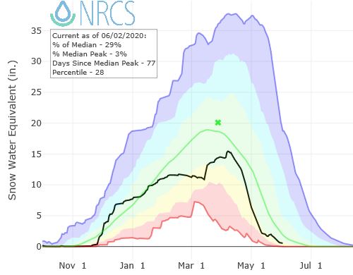
Interactive SNOTEL ChartsCharts for snowpack, precipitation, air temp and soil moisture
|

|
|
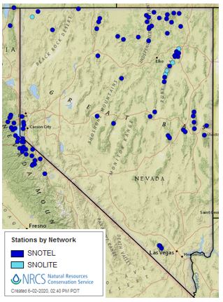
Interactive MapDisplays both current and historic data in an easy-to-use, visual interface. Data types include SNOTEL, snow course, streamflow, reservoir storage, and streamflow forecasts and more. |
|
|
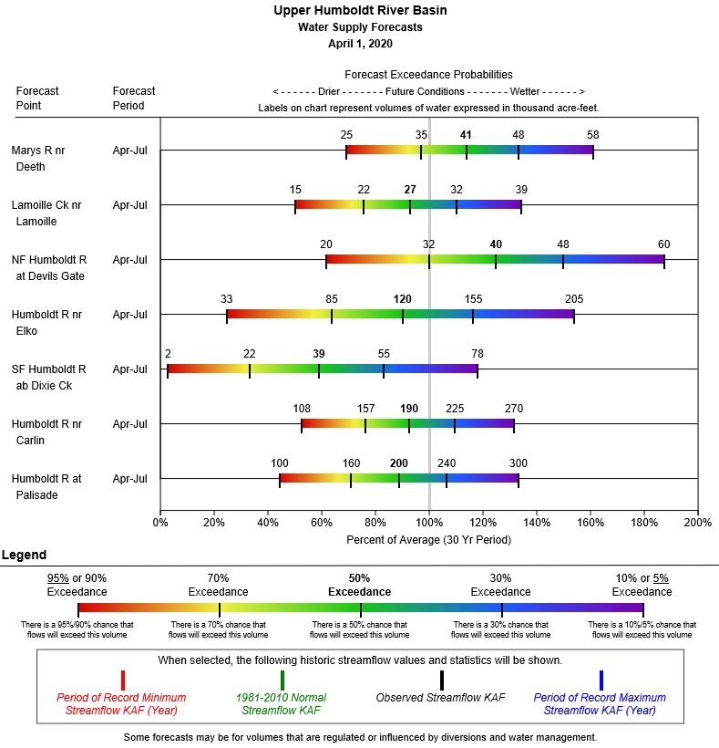
Streamflow Forecast ChartsVisual representation of streamflow forecast range showing the five exceedance probabilities compared to 30-year normals.
Other Forecast Products - Tables, Maps, Unofficial Daily Forecasts |
Snow Survey Data* |
Water Supply Information |
|
Snow Survey Products |
Climate and Drought Information
|
|
Data Query Tools
|
Other Resources: |
|
* SNOTEL Data Quality: Snow Survey staff review and quality-control only the daily (midnight) readings from SNOTEL sites. HOURLY DATA, OTHER THAN THE MIDNIGHT VALUES, SHOULD BE CONSIDERED PROVISIONAL AND MAY HAVE SIGNIFICANT ERRORS. The only data that are reviewed at the hourly time step are the soil moisture and soil temperature values. In addition, the extended range air temperature sensors used at SNOTEL sites in the continental U.S. calculate temperature from sensor output voltage using a linear least-squares regression algorithm. It has been determined that the this algorithm has resulted in a data bias. The Snow Survey and Water Supply Forecasting Program is actively working on a correction technique for this issue. More information: Click Here
|